Portal:Peninsula/es-419: Difference between revisions
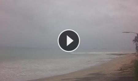
Created page with "Salinas San Lorenzo / Paco Illescas" |
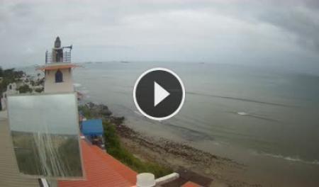
Created page with "Playa de Ballenita – Capaes" |
||
| Line 126: | Line 126: | ||
<div style="height:4px; background:#1d6b40;"></div> | <div style="height:4px; background:#1d6b40;"></div> | ||
<div style="padding:13px 14px 10px;"> | <div style="padding:13px 14px 10px;"> | ||
<div style="font-family:Arial,sans-serif; font-size:9px; letter-spacing:1.5px; text-transform:uppercase; font-weight:bold; color:#1d6b40; margin-bottom:4px; | <div style="font-family:Arial,sans-serif; font-size:9px; letter-spacing:1.5px; text-transform:uppercase; font-weight:bold; color:#1d6b40; margin-bottom:4px;">Ballenita · Bahía Este</div> | ||
<div style="font-size:1em; font-weight:bold; color:#003d5c; margin-bottom:8px; | <div style="font-size:1em; font-weight:bold; color:#003d5c; margin-bottom:8px;">Playa de Ballenita – Capaes</div> | ||
<html><a href="https://www.skylinewebcams.com/en/webcam/ecuador/santa-elena/santa-elena/playa-de-ballenita-capaes.html" target="_blank"><img src="https://embed.skylinewebcams.com/img/3724.jpg" alt="【LIVE】 Playa de Ballenita - Capaes | SkylineWebcams" style="width:100%; height:auto; display:block; border-radius:3px;"></a></html> | <html><a href="https://www.skylinewebcams.com/en/webcam/ecuador/santa-elena/santa-elena/playa-de-ballenita-capaes.html" target="_blank"><img src="https://embed.skylinewebcams.com/img/3724.jpg" alt="【LIVE】 Playa de Ballenita - Capaes | SkylineWebcams" style="width:100%; height:auto; display:block; border-radius:3px;"></a></html> | ||
<div style="font-family:Arial,sans-serif; font-size:0.78em; color:#8a8a8a; margin-top:8px; line-height:1.4;"> | <div style="font-family:Arial,sans-serif; font-size:0.78em; color:#8a8a8a; margin-top:8px; line-height:1.4;">Playa de Ballenita. Haz clic en la imagen para ver la transmisión en vivo.</div> | ||
</div> | </div> | ||
|} | |} | ||
| Line 136: | Line 136: | ||
<!-- ── PARISHES ── --> | <!-- ── PARISHES ── --> | ||
<div style="display:flex; align-items:center; gap:12px; margin:32px 0 14px;"> | <div style="display:flex; align-items:center; gap:12px; margin:32px 0 14px;"> | ||
<span style="font-size:1.25em; font-weight:bold; color:#003d5c; white-space:nowrap;"> | <span style="font-size:1.25em; font-weight:bold; color:#003d5c; white-space:nowrap;">Parroquias y Pueblos Costeros</span> | ||
<span style="flex:1; height:1px; background:#d0dce8; display:block;"></span> | <span style="flex:1; height:1px; background:#d0dce8; display:block;"></span> | ||
</div> | </div> | ||
| Line 144: | Line 144: | ||
| style="width:33%; border:1px solid #d0dce8; border-radius:5px; padding:11px 13px; vertical-align:top; background:#ffffff;" | | | style="width:33%; border:1px solid #d0dce8; border-radius:5px; padding:11px 13px; vertical-align:top; background:#ffffff;" | | ||
<div style="font-weight:bold; font-size:0.95em; color:#003d5c; margin-bottom:3px;">[[Ballenita]]</div> | <div style="font-weight:bold; font-size:0.95em; color:#003d5c; margin-bottom:3px;">[[Ballenita]]</div> | ||
<div style="font-family:Arial,sans-serif; font-size:0.78em; color:#8a8a8a;"> | <div style="font-family:Arial,sans-serif; font-size:0.78em; color:#8a8a8a;">Miradores de ballenas · Farallón Dillon · Surf</div> | ||
| style="width:33%; border:1px solid #d0dce8; border-radius:5px; padding:11px 13px; vertical-align:top; background:#ffffff;" | | | style="width:33%; border:1px solid #d0dce8; border-radius:5px; padding:11px 13px; vertical-align:top; background:#ffffff;" | | ||
<div style="font-weight:bold; font-size:0.95em; color:#003d5c; margin-bottom:3px;">[[Ancón]]</div> | <div style="font-weight:bold; font-size:0.95em; color:#003d5c; margin-bottom:3px;">[[Ancón]]</div> | ||
<div style="font-family:Arial,sans-serif; font-size:0.78em; color:#8a8a8a;"> | <div style="font-family:Arial,sans-serif; font-size:0.78em; color:#8a8a8a;">Primer pozo petrolero · Arquitectura británica · Acantilados</div> | ||
| style="width:33%; border:1px solid #d0dce8; border-radius:5px; padding:11px 13px; vertical-align:top; background:#ffffff;" | | | style="width:33%; border:1px solid #d0dce8; border-radius:5px; padding:11px 13px; vertical-align:top; background:#ffffff;" | | ||
<div style="font-weight:bold; font-size:0.95em; color:#003d5c; margin-bottom:3px;">[[Anconcito]]</div> | <div style="font-weight:bold; font-size:0.95em; color:#003d5c; margin-bottom:3px;">[[Anconcito]]</div> | ||
<div style="font-family:Arial,sans-serif; font-size:0.78em; color:#8a8a8a;"> | <div style="font-family:Arial,sans-serif; font-size:0.78em; color:#8a8a8a;">Capital pesquera · Langosta · Acantilados de betún</div> | ||
|- | |- | ||
| style="border:1px solid #d0dce8; border-radius:5px; padding:11px 13px; vertical-align:top; background:#ffffff;" | | | style="border:1px solid #d0dce8; border-radius:5px; padding:11px 13px; vertical-align:top; background:#ffffff;" | | ||
<div style="font-weight:bold; font-size:0.95em; color:#003d5c; margin-bottom:3px;">[[Punta Blanca]]</div> | <div style="font-weight:bold; font-size:0.95em; color:#003d5c; margin-bottom:3px;">[[Punta Blanca]]</div> | ||
<div style="font-family:Arial,sans-serif; font-size:0.78em; color:#8a8a8a;"> | <div style="font-family:Arial,sans-serif; font-size:0.78em; color:#8a8a8a;">Acantilados blancos · Playa de 3.7 km · Ideal para familias</div> | ||
| style="border:1px solid #d0dce8; border-radius:5px; padding:11px 13px; vertical-align:top; background:#ffffff;" | | | style="border:1px solid #d0dce8; border-radius:5px; padding:11px 13px; vertical-align:top; background:#ffffff;" | | ||
<div style="font-weight:bold; font-size:0.95em; color:#003d5c; margin-bottom:3px;">[[Baños de San Vicente]]</div> | <div style="font-weight:bold; font-size:0.95em; color:#003d5c; margin-bottom:3px;">[[Baños de San Vicente]]</div> | ||
<div style="font-family:Arial,sans-serif; font-size:0.78em; color:#8a8a8a;"> | <div style="font-family:Arial,sans-serif; font-size:0.78em; color:#8a8a8a;">Aguas termales · Volcán de lodo · Interior</div> | ||
| style="border:1px solid #d0dce8; border-radius:5px; padding:11px 13px; vertical-align:top; background:#ffffff;" | | | style="border:1px solid #d0dce8; border-radius:5px; padding:11px 13px; vertical-align:top; background:#ffffff;" | | ||
<div style="font-weight:bold; font-size:0.95em; color:#003d5c; margin-bottom:3px;">[[Chanduy]]</div> | <div style="font-weight:bold; font-size:0.95em; color:#003d5c; margin-bottom:3px;">[[Chanduy]]</div> | ||
<div style="font-family:Arial,sans-serif; font-size:0.78em; color:#8a8a8a;"> | <div style="font-family:Arial,sans-serif; font-size:0.78em; color:#8a8a8a;">Salares · Flamencos · Pesca tradicional</div> | ||
|} | |} | ||
| Line 166: | Line 166: | ||
<!-- ── ROUTE BANNER ── --> | <!-- ── ROUTE BANNER ── --> | ||
<div style="background:#003d5c; border-radius:6px; padding:24px 28px; color:#ffffff; margin:28px 0;"> | <div style="background:#003d5c; border-radius:6px; padding:24px 28px; color:#ffffff; margin:28px 0;"> | ||
<div style="font-size:1.1em; font-weight:bold; margin-bottom:6px;"> | <div style="font-size:1.1em; font-weight:bold; margin-bottom:6px;">De la Península a Manabí</div> | ||
<div style="font-family:Arial,sans-serif; font-size:0.88em; color:rgba(255,255,255,0.75); line-height:1.55; margin-bottom:14px;"> | <div style="font-family:Arial,sans-serif; font-size:0.88em; color:rgba(255,255,255,0.75); line-height:1.55; margin-bottom:14px;">Al norte de Salinas, la [[Portal:Ruta del Spondylus|Ruta del Spondylus]] (E-15) atraviesa [[Ayangue]], [[Manglaralto]], [[Montañita]], [[Olón]] y más allá — pueblos de surf, caletas de pescadores y promontorios de bosque nublado. La península es el punto de partida, no el destino.</div> | ||
'''[[Portal:Ruta del Spondylus| | '''[[Portal:Ruta del Spondylus|→ Guía de la Ruta del Spondylus]]''' · [[Beaches|Playas]] · [[Understanding Public Transportation in La Peninsula|Cómo moverte]] | ||
</div> | </div> | ||
| Line 174: | Line 174: | ||
<!-- ── GEOGRAPHY & CLIMATE ── --> | <!-- ── GEOGRAPHY & CLIMATE ── --> | ||
<div style="display:flex; align-items:center; gap:12px; margin:32px 0 14px;"> | <div style="display:flex; align-items:center; gap:12px; margin:32px 0 14px;"> | ||
<span style="font-size:1.25em; font-weight:bold; color:#003d5c; white-space:nowrap;"> | <span style="font-size:1.25em; font-weight:bold; color:#003d5c; white-space:nowrap;">Geografía y Clima</span> | ||
<span style="flex:1; height:1px; background:#d0dce8; display:block;"></span> | <span style="flex:1; height:1px; background:#d0dce8; display:block;"></span> | ||
</div> | </div> | ||
| Line 182: | Line 182: | ||
| style="width:50%; background:#f5ede0; border-radius:5px; padding:16px 18px; vertical-align:top;" | | | style="width:50%; background:#f5ede0; border-radius:5px; padding:16px 18px; vertical-align:top;" | | ||
<div style="font-weight:bold; color:#8b6344; margin-bottom:5px;"><span lang="en" dir="ltr" class="mw-content-ltr">Physical Setting</span></div> | <div style="font-weight:bold; color:#8b6344; margin-bottom:5px;"><span lang="en" dir="ltr" class="mw-content-ltr">Physical Setting</span></div> | ||
<div style="font-family:Arial,sans-serif; font-size:0.86em; color:#4a4a4a; line-height:1.6;"> | <div style="font-family:Arial,sans-serif; font-size:0.86em; color:#4a4a4a; line-height:1.6;">La península es la extensión más septentrional del sistema desértico de la costa oeste. Limitada al sur por el golfo de Guayaquil y al norte por la bahía de Santa Elena, es una meseta árida con espectaculares acantilados sobre el Pacífico en su borde exterior.</div> | ||
| style="width:50%; background:#f5ede0; border-radius:5px; padding:16px 18px; vertical-align:top;" | | | style="width:50%; background:#f5ede0; border-radius:5px; padding:16px 18px; vertical-align:top;" | | ||
<div style="font-weight:bold; color:#8b6344; margin-bottom:5px;"><span lang="en" dir="ltr" class="mw-content-ltr">Ocean Currents</span></div> | <div style="font-weight:bold; color:#8b6344; margin-bottom:5px;"><span lang="en" dir="ltr" class="mw-content-ltr">Ocean Currents</span></div> | ||
Revision as of 00:33, 16 August 2026
|
260K+
Residentes
|
3
Cantones
|
8,000
Años habitado
|
1911
Primer pozo petrolero
|
250K
Turistas / temporada
|
|
"A compact strip of Pacific coast with some of the most diverse beach conditions, archaeology, and marine life in South America."
The Santa Elena Peninsula is Ecuador's westernmost continental point — bounded by the Gulf of Guayaquil to the south and Santa Elena Bay to the north. Its three cantons — Salinas, La Libertad, and Santa Elena — form a continuous urban conurbation that fades outward into fishing hamlets, salt flats, and cliff-edged headlands. This is not a homogeneous coast. Salinas is Ecuador's premier beach resort, loud with jet-skis and night markets in high season. Fifteen minutes east, La Libertad is workaday and commercial — its Terminal Pesquero one of the most active fishing ports in the country. And inland, the provincial capital Santa Elena guards the Amantes de Sumpa, the 8,000-year-old lovers who are among the oldest human remains in the Americas. Beyond the conurbation, the peninsula turns quieter: Ancón preserves British company-town architecture and Ecuador's first oil well. Anconcito hauls in langosta by dawn light. Ballenita offers one of the coast's best whale-watching perches from June to September. And Punta Blanca stretches its white-cliff beach in near-total peace.
The Three Cantons Politically separated but physically merged — each with its own character, economy, and reason to be here.
Cámaras de playa en vivo Condiciones actuales en la península — las imágenes se actualizan automáticamente. Haz clic para abrir la transmisión en vivo.
Parroquias y Pueblos Costeros
De la Península a Manabí
Al norte de Salinas, la Ruta del Spondylus (E-15) atraviesa Ayangue, Manglaralto, Montañita, Olón y más allá — pueblos de surf, caletas de pescadores y promontorios de bosque nublado. La península es el punto de partida, no el destino.
Geografía y Clima
History in Brief 6800 BC
Las Vegas culture — the first documented human settlement in Ecuador — flourishes on the peninsula. The Sumpa cemetery contains 200 burials, including the Amantes de Sumpa: a couple buried facing each other in an 8,000-year embrace.
Pre-contact
Valdivia, Machalilla, and Chorrera cultures succeed Las Vegas. The Spondylus shell becomes a sacred trade item, giving name to the modern Ruta del Spondylus that follows these ancient exchange routes.
1911
Ancón 1 — Ecuador's first commercial oil well — is drilled by the Anglo-Ecuadorian Oil Company. British engineers build a company town whose architecture still stands today, a designated heritage geosite.
1977
Karen Stothert's excavations at Sumpa uncover the pre-ceramic cemetery, establishing it as the most meticulously documented archaeological site in Ecuador.
2007
Santa Elena Province is created, separating from Guayas. The three cantons gain their own provincial administration for the first time.
Natural Environment
Outdoor Activities Each activity links to its own page with spots, conditions, access, difficulty, and local operators.
Living & Getting Around
|
|