|
"Un camino que no solo conecta lugares — conecta formas de vida. Cada pocos kilómetros la costa se reinventa."
La Ruta del Spondylus toma su nombre de la concha de ostra espinosa que fue el artículo de comercio más sagrado del Ecuador precolombino. Durante milenios, los pueblos costeros intercambiaron el Spondylus como moneda, ofrenda y símbolo de lluvia y fertilidad — y la red de comunidades a lo largo de esta costa fueron quienes lo recolectaron, comerciaron y veneraron.
Hoy la ruta es la carretera E-15, que va hacia el norte desde la Península de Santa Elena, atraviesa la Provincia de Santa Elena y llega hasta Manabí. Pasa por una docena de pueblos distintos, cada uno con su propio carácter: Ayangue es una caleta turquesa protegida, perfecta para bucear con esnórquel. Manglaralto es tranquilo y local. Montañita es uno de los destinos de surf más conocidos internacionalmente en Sudamérica. Olón tiene una playa amplia y apacible y una iglesia en lo alto de un acantilado visible desde kilómetros de distancia. Más al norte, la costa se vuelve más salvaje — caballos en la playa de San José, acantilados dramáticos en La Rinconada, retiros de yoga y bosque nuboso en Ayampe.
La ruta se puede recorrer fácilmente en bus desde el Terminal Terrestre de La Libertad, con salidas frecuentes durante todo el día.
Enumerados de sur a norte, en orden de viaje desde la península.
Bahía Protegida
Una caleta turquesa resguardada apodada la "Piscina del Pacífico" — tranquila, cálida y lo bastante clara para bucear con esnórquel todo el año. Uno de los lugares más visitados de toda la ruta.
Esnórquel
Mejor actividad
|
Alma Local
Un tranquilo pueblo de pescadores con manglares centenarios, una larga playa de arena gris y casi ninguna infraestructura turística — que es precisamente su atractivo. Lento, auténtico, local.
Manglares
Atractivo natural
|
Capital del Surf
El pueblo de surf más conocido internacionalmente de Ecuador. Un pueblo compacto y enérgico con olas constantes, una escena mochilera global y una vida nocturna que supera a cualquier otro pueblo de la costa.
Surf · Vida nocturna
Conocido por
|
Retiro Familiar
Una playa larga y extensa con una iglesia en lo alto de un acantilado en un extremo y una vista que se extiende hasta el horizonte. Tranquila, apta para familias y un contraste perfecto con la vecina Montañita.
Iglesia de Olón
Punto de referencia
|
Vistas desde el Acantilado
Una pequeña comunidad en lo alto de un acantilado entre Olón y San José, conocida por sus vistas elevadas al océano, un ritmo más tranquilo y un puñado de alquileres exclusivos con asientos de primera fila frente al Pacífico.
Miradores al océano
Mejor característica
|
Costas Salvajes
Uno de los tramos más vírgenes de la ruta. Los caballos pastan en la playa durante la marea baja, los botes de pesca zarpan al amanecer, y los únicos sonidos son el oleaje y las aves.
Cabalgatas
Actividad principal
|
Espíritu Artístico
Una pequeña caleta de pescadores con una reputación creciente por su arte local y su vida tranquila. Murales pintados en el malecón y artesanos que venden directamente desde sus talleres.
Murales · Artesanías
Conocido por
|
Hora Dorada
Una comunidad de entrada en el extremo norte de la Provincia de Santa Elena, donde comienza el paisaje de Manabí. Conocida por sus atardeceres dramáticos y murales pintados frente al mar.
Límite provincial
Punto de transición
|
Acantilados Dramáticos
Altos acantilados costeros con vistas imponentes hacia el norte y el sur. Un lugar excelente para la observación de aves y una de las paradas más fotogénicas de toda la ruta.
Observación de aves
Mejor actividad
|
Surf y Alma
Donde el bosque nuboso se encuentra con el Pacífico. Un pueblo diminuto con olas constantes, retiros de yoga, comida orgánica y una biodiversidad que sorprende a la mayoría de los visitantes. Uno de los secretos mejor guardados de la ruta.
Bosque nuboso · Yoga
Conocido por
|
Paso de Ballenas
A quiet northern community where humpback whales pass close to shore in season, hanging bridges cross jungle streams, and the freshest seafood arrives hours after it left the water.
|
Interior Detour
A small community in the hills above Manglaralto. The starting point for guided treks through the Loma Alta Ecological Reserve — cloud forest, endemic birds, and total quiet.
Loma Alta Reserve
Hiking base
|
Current conditions along the route — images refresh automatically. Click any image to open the live feed.
Ayangue · Protected Bay
Ayangue Beach
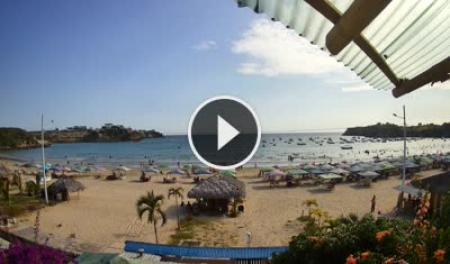
The sheltered bay — check water clarity and how busy the snorkeling spot is. Click image for live feed.
|
Montañita · Town
Montañita Pueblo
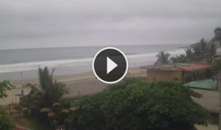
Town-side view — crowd level and general conditions. Click image for live feed.
|
Montañita · Surf Break
Montañita La Punta
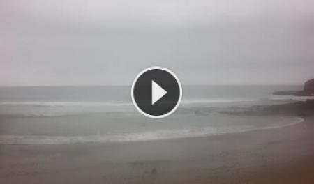
The point break — swell size, shape, and crowd in the lineup. Click image for live feed.
|
Ayampe · Cloud Forest Coast
Playa Ayampe
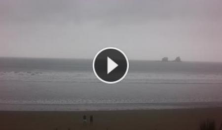
Where the forest meets the Pacific — surf and wind conditions at the north end of the route. Click image for live feed.
|
Las Tunas · Manabí
Las Tunas Beach
Northern end of the route — whale watching corridor Jun–Sep. Click image for live feed.
|
|
Images refresh every few minutes on the SkylineWebcams servers. Cams run south to north in route order.
Starting from the Peninsula
The Ruta del Spondylus begins where the Santa Elena Peninsula ends. Frequent buses run north from La Libertad's Terminal Terrestre throughout the day, stopping at every town along the route. You can travel the full length in a single day, or base yourself in one town and explore on foot.
→ Bus routes and fares guide · Peninsula portal
|
The Coast Changes
South of Montañita the coast is relatively flat and open. North of it, the terrain grows dramatic — cliffs, rocky headlands, and hills pushing close to the water. By Ayampe, the cloud forest reaches the shoreline.
|
Surf Conditions
Montañita has the most consistent and powerful surf on the route. Ayangue has almost none — its bay is sheltered year-round. Most other beaches are intermediate, best in the southern swell season of December through April.
|
|
High Season (Dec–May)
Warmest water, strongest surf, most visitors. Montañita fills up completely. Book accommodation weeks ahead for Carnival. Ayangue and Olón are calmer alternatives.
|
Low Season (Jun–Nov)
Cooler, windier, emptier. Prices drop significantly — some places by half. Whale watching is at its peak June through September. The cloud forest at Ayampe and Dos Mangas is at its greenest.
|
3500 BC onwards
The Spondylus princeps — the thorny oyster — is harvested by coastal divers along this stretch of coast. It becomes the single most important trade item in pre-Columbian South America, exchanged from Ecuador to Chile and from the coast to the high Andes.
Ritual significance
Andean cultures — including the Inca — believed Spondylus had the power to bring rain. Its crimson interior color was associated with blood, sacrifice, and the sea goddess. Only nobility and priests could possess it.
The trade network
The coastal communities along this route were the source. Balsa-wood trading vessels — some large enough for 20 people — carried shells north and south. The Spanish conquistadors first encountered these boats off the coast of what is now Santa Elena Province.
Today
The shell gives its name to the modern highway, and local artisans still carve and sell Spondylus jewelry in Montañita and other market towns along the route. The diving tradition that started 5,000 years ago continues in Ayangue and Anconcito.
|
🐋
Humpback Whales
June–September, the entire route becomes a whale-watching corridor. Best viewpoints at Las Tunas, La Rinconada, and from charter boats out of Montañita.
|
🌿
Cloud Forest
The Loma Alta Ecological Reserve above Manglaralto and the forest around Ayampe are two of the most biodiverse patches on the Ecuadorian coast. Endemic bird species, orchids, and howler monkeys.
|
🦜
Birdwatching
La Rinconada's cliffs attract both seabirds and raptors. The mangroves of Manglaralto shelter herons, kingfishers, and seasonal migrants. Best in the early morning year-round.
|
|
🌳
Mangroves
Manglaralto's estuary preserves one of the last old-growth mangrove stands on this stretch of coast. Navigable by kayak or small boat at high tide.
|
🤿
Marine Life
Ayangue's protected bay has the clearest water on the route — sea turtles, rays, and reef fish are regularly sighted. Snorkeling gear available to rent from several operators in town.
|
🏄
Surf Breaks
Montañita's main break is the most consistent on the route. Smaller breaks at Olón, San José, and Ayampe suit intermediate surfers. Surf schools operate in Montañita year-round.
|
Each activity links to its own page with spots, conditions, access, difficulty, and local operators.
🌊 Water
| Activity
|
Where on the route
|
| Surfing
|
Montañita main break (best and most consistent), Olón, San José, Ayampe — Dec–Apr peak swell
|
| Snorkeling
|
Ayangue bay — the clearest water on the entire route, gear for rent in town
|
| Scuba Diving
|
Ayangue — protected bay with reef, operators in town
|
| Swimming
|
Ayangue (safest, no current), Olón (wide calm beach), Manglaralto bay
|
| Kayaking
|
Manglaralto estuary at high tide — mangrove paddling, rentals in Montañita
|
| Whale Watching
|
Las Tunas and La Rinconada cliffs — Jun–Sep. Boat tours depart from Montañita
|
| Sea Turtle Watching
|
Ayangue bay — turtles regularly sighted while snorkeling and from the headland
|
| Stand-Up Paddleboarding
|
Ayangue bay and Olón on calm mornings — rentals available in Montañita
|
| Mangrove Boating
|
Manglaralto estuary — small boat or kayak at high tide, ask locally for guides
|
| Fishing
|
Shore fishing at San José, Ayampe, Las Tunas — artisanal boat trips from any fishing village
|
| Bodyboarding
|
Montañita and Olón — same breaks as surfing, smaller commitment
|
| River Swimming
|
Río Ayampe mouth — freshwater river meeting the sea, best in low season
|
🏃 Land
| Activity
|
Where on the route
|
| Hiking
|
Loma Alta Reserve (via Dos Mangas), Ayampe cloud forest trails, La Rinconada cliff paths
|
| Horseback Riding
|
San José beach at low tide — ask in the village for the operator
|
| Running
|
Olón beach (flat, long, uncrowded), Manglaralto beachfront, low-tide packed sand anywhere
|
| Cycling
|
E-15 coastal road — paved full length, best early morning before traffic. Rentals in Montañita
|
| Yoga
|
Ayampe (dedicated retreat centers), Montañita (multiple studios), Olón beach at sunrise
|
| Surfing Lessons
|
Montañita — multiple schools operating year-round on the main beach
|
| Beach Volleyball
|
Montañita and Olón — nets on the beach, pickup games in high season
|
| Football / Soccer
|
Every village has a pitch — Manglaralto and Montañita have the most active local leagues
|
| Skateboarding
|
Montañita main street — smooth pavement, flat, DIY spots near the park
|
| Kite Flying
|
Olón beach — consistent afternoon wind, long open stretch, few obstacles
|
| Slacklining
|
Montañita park — trees available, local community brings lines on weekends
|
| Camping
|
Ayampe and Olón — informal beach camping, ask locally for permitted spots
|
| Walking the Dog
|
Manglaralto and San José beachfronts — quiet, local, almost no traffic
|
🌿 Nature & Other
| Activity
|
Where on the route
|
| Birdwatching
|
La Rinconada cliffs (raptors & seabirds), Ayampe forest (endemic species), Manglaralto mangroves (herons, kingfishers)
|
| Cloud Forest Trekking
|
Loma Alta Reserve via Dos Mangas — guided treks only, arrange in the village
|
| Wildlife Spotting
|
Ayampe — howler monkeys audible from shore, visible at the forest edge at dawn
|
| Paragliding
|
La Rinconada — clifftop thermals, launch point above the headland
|
| Jungle Hiking
|
Las Tunas hanging bridges — suspension bridges over jungle streams, accessible on foot
|
| Tide Pool Exploring
|
Rocky points at Montañita and Ayangue at low tide
|
| Stargazing
|
North of Montañita toward San José and Ayampe — minimal light pollution, faces open ocean
|
| Photography
|
Las Nuñez murals, La Rinconada cliffs, Ayangue bay at low tide, Montañita sunrise from the point
|
| Meditation Retreats
|
Ayampe — several dedicated retreat centers, book in advance
|
| Geocaching
|
Active caches around Montañita and Ayangue — check geocaching.com for current listings
|
| Fruit Picking
|
Roadside farms along E-15 between Manglaralto and Montañita — seasonal, ask at roadside stands
|
|
🚍By Bus from La Libertad
Frequent departures from Terminal Terrestre throughout the day. Buses stop at every town.
|
🚕By Taxi or Private Transfer
Shared taxis run between towns. Negotiate the fare before you get in.
|
|
🛵Motorbike or Bicycle
The E-15 is paved the full length. Rentals available in Montañita.
|
🚗By Car from Guayaquil
~2.5 hours to Montañita via the E-40 and E-15. Road is paved and well-signed.
|
|
At a Glance
| Province
|
Santa Elena → Manabí
|
| Highway
|
E-15 (Ruta del Sol)
|
| Length
|
~200 km
|
| Start point
|
La Libertad
|
| Key towns
|
Ayangue, Montañita, Olón, Ayampe
|
| Currency
|
US Dollar (USD)
|
| Languages
|
Spanish · English is the 2nd language for many people
|
Seasonal Guide
Dec–May
High season. Strong surf, warm water. Montañita at full capacity. Book ahead.
February
Carnival — the biggest celebration on the coast. Roads and accommodation fill weeks in advance.
Jun–Sep
Whale season. Fewer tourists, lower prices. Cloud forest at its most lush.
Oct–Nov
Shoulder season. Quietest and cheapest. Surf is moderate, weather is mild.
🗓️ Best by Season
Dec–May
Surfing, snorkeling, swimming, stand-up paddleboarding. Warmest water, strongest swell.
Jun–Sep
Whale watching, birdwatching, cloud forest trekking. Cooler, emptier, cheaper.
Year-round
Yoga, fishing, horseback riding, running, cycling the E-15.
Dawn
Any fishing village on the route. Nets out, boats in, coffee on.
Not to Miss
🤿
The clearest water on the entire coast. Gear for rent in town.
🏄
Best consistent break on the route. Schools for all levels.
🌿
Where the jungle meets the Pacific. Best-kept secret on the route.
🐋
June–September. Las Tunas and La Rinconada are the best spots.
🏗️ Help Build This Page
This portal is a living document. If you know this coast — add what you know.
|