Portal:Ruta del Spondylus/es: Difference between revisions
Spanish translation |
Spanish translation |
||
| Line 199: | Line 199: | ||
<div style="font-family:Arial,sans-serif; font-size:10px; letter-spacing:1.5px; text-transform:uppercase; font-weight:bold; color:#1db894; margin-bottom:3px;">Paso de Ballenas</div> | <div style="font-family:Arial,sans-serif; font-size:10px; letter-spacing:1.5px; text-transform:uppercase; font-weight:bold; color:#1db894; margin-bottom:3px;">Paso de Ballenas</div> | ||
<div style="font-size:1.1em; font-weight:bold; color:#0a4a3a; margin-bottom:7px;">[[Las Tunas]]</div> | <div style="font-size:1.1em; font-weight:bold; color:#0a4a3a; margin-bottom:7px;">[[Las Tunas]]</div> | ||
<div style="font-family:Arial,sans-serif; font-size:0.82em; color:#6a6a6a; line-height:1.55;"> | <div style="font-family:Arial,sans-serif; font-size:0.82em; color:#6a6a6a; line-height:1.55;">Una tranquila comunidad del norte donde las ballenas jorobadas pasan cerca de la orilla en temporada, puentes colgantes cruzan arroyos de la selva, y los mariscos más frescos llegan horas después de salir del agua.</div> | ||
<div style="margin-top:10px; padding-top:10px; border-top:1px solid #e8f5ef;"> | <div style="margin-top:10px; padding-top:10px; border-top:1px solid #e8f5ef;"> | ||
<span style="font-size:0.82em; font-weight:bold; color:#0a7a5a;"> | <span style="font-size:0.82em; font-weight:bold; color:#0a7a5a;">Avistamiento de ballenas</span> | ||
<span style="font-family:Arial,sans-serif; font-size:9px; letter-spacing:1px; text-transform:uppercase; color:#9a9a9a; display:block;">Jun–Sep</span> | <span style="font-family:Arial,sans-serif; font-size:9px; letter-spacing:1px; text-transform:uppercase; color:#9a9a9a; display:block;">Jun–Sep</span> | ||
</div> | </div> | ||
| Line 208: | Line 208: | ||
<div style="height:4px; background:#0a7a5a;"></div> | <div style="height:4px; background:#0a7a5a;"></div> | ||
<div style="padding:14px 16px;"> | <div style="padding:14px 16px;"> | ||
<div style="font-family:Arial,sans-serif; font-size:10px; letter-spacing:1.5px; text-transform:uppercase; font-weight:bold; color:#0a7a5a; margin-bottom:3px;"> | <div style="font-family:Arial,sans-serif; font-size:10px; letter-spacing:1.5px; text-transform:uppercase; font-weight:bold; color:#0a7a5a; margin-bottom:3px;">Desvío al Interior</div> | ||
<div style="font-size:1.1em; font-weight:bold; color:#0a4a3a; margin-bottom:7px;">[[Dos Mangas]]</div> | <div style="font-size:1.1em; font-weight:bold; color:#0a4a3a; margin-bottom:7px;">[[Dos Mangas]]</div> | ||
<div style="font-family:Arial,sans-serif; font-size:0.82em; color:#6a6a6a; line-height:1.55;"> | <div style="font-family:Arial,sans-serif; font-size:0.82em; color:#6a6a6a; line-height:1.55;">Una pequeña comunidad en las colinas sobre Manglaralto. El punto de partida para caminatas guiadas por la Reserva Ecológica Loma Alta — bosque nuboso, aves endémicas y total tranquilidad.</div> | ||
<div style="margin-top:10px; padding-top:10px; border-top:1px solid #e8f5ef;"> | <div style="margin-top:10px; padding-top:10px; border-top:1px solid #e8f5ef;"> | ||
<span style="font-size:0.82em; font-weight:bold; color:#0a7a5a;">Loma Alta Reserve</span> | <span style="font-size:0.82em; font-weight:bold; color:#0a7a5a;">Loma Alta Reserve</span> | ||
<span style="font-family:Arial,sans-serif; font-size:9px; letter-spacing:1px; text-transform:uppercase; color:#9a9a9a; display:block;"> | <span style="font-family:Arial,sans-serif; font-size:9px; letter-spacing:1px; text-transform:uppercase; color:#9a9a9a; display:block;">Base de senderismo</span> | ||
</div> | </div> | ||
</div> | </div> | ||
| Line 221: | Line 221: | ||
<!-- ── LIVE BEACH CAMS ── --> | <!-- ── LIVE BEACH CAMS ── --> | ||
<div style="display:flex; align-items:center; gap:12px; margin:32px 0 14px;"> | <div style="display:flex; align-items:center; gap:12px; margin:32px 0 14px;"> | ||
<span style="font-size:1.25em; font-weight:bold; color:#0a4a3a; white-space:nowrap;"> | <span style="font-size:1.25em; font-weight:bold; color:#0a4a3a; white-space:nowrap;">Cámaras en Vivo de las Playas</span> | ||
<span style="flex:1; height:1px; background:#c8e6dc; display:block;"></span> | <span style="flex:1; height:1px; background:#c8e6dc; display:block;"></span> | ||
</div> | </div> | ||
<div style="font-family:Arial,sans-serif; font-size:0.85em; color:#6a6a6a; line-height:1.6; margin-bottom:14px;"> | <div style="font-family:Arial,sans-serif; font-size:0.85em; color:#6a6a6a; line-height:1.6; margin-bottom:14px;">Condiciones actuales a lo largo de la ruta — las imágenes se actualizan automáticamente. Haz clic en cualquier imagen para abrir la transmisión en vivo.</div> | ||
<!-- Row 1 --> | <!-- Row 1 --> | ||
| Line 233: | Line 233: | ||
<div style="height:4px; background:#1db894;"></div> | <div style="height:4px; background:#1db894;"></div> | ||
<div style="padding:13px 14px 10px;"> | <div style="padding:13px 14px 10px;"> | ||
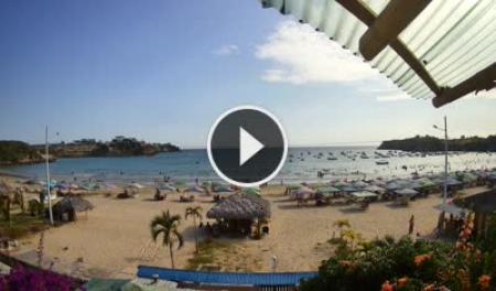
<div style="font-family:Arial,sans-serif; font-size:9px; letter-spacing:1.5px; text-transform:uppercase; font-weight:bold; color:#1db894; margin-bottom:4px; | <div style="font-family:Arial,sans-serif; font-size:9px; letter-spacing:1.5px; text-transform:uppercase; font-weight:bold; color:#1db894; margin-bottom:4px;">Ayangue · Bahía Protegida</div> | ||
<div style="font-size:1em; font-weight:bold; color:#0a4a3a; margin-bottom:8px;"> | <div style="font-size:1em; font-weight:bold; color:#0a4a3a; margin-bottom:8px;">Playa Ayangue</div> | ||
<html><a href="https://www.skylinewebcams.com/en/webcam/ecuador/santa-elena/santa-elena/ayangue-beach.html" target="_blank"><img src="https://embed.skylinewebcams.com/img/748.jpg" alt="【LIVE】 Ecuador - Ayangue Beach | SkylineWebcams" style="width:100%; height:auto; display:block; border-radius:3px;"></a></html> | <html><a href="https://www.skylinewebcams.com/en/webcam/ecuador/santa-elena/santa-elena/ayangue-beach.html" target="_blank"><img src="https://embed.skylinewebcams.com/img/748.jpg" alt="【LIVE】 Ecuador - Ayangue Beach | SkylineWebcams" style="width:100%; height:auto; display:block; border-radius:3px;"></a></html> | ||
<div style="font-family:Arial,sans-serif; font-size:0.78em; color:#8a8a8a; margin-top:8px; line-height:1.4;"> | <div style="font-family:Arial,sans-serif; font-size:0.78em; color:#8a8a8a; margin-top:8px; line-height:1.4;">La bahía resguardada — comprueba la claridad del agua y qué tan concurrido está el lugar para bucear con esnórquel. Haz clic en la imagen para ver la transmisión en vivo.</div> | ||
</div> | </div> | ||
| style="width:50%; border:1px solid #c8e6dc; border-radius:6px; overflow:hidden; vertical-align:top; padding:0; background:#ffffff;" | | | style="width:50%; border:1px solid #c8e6dc; border-radius:6px; overflow:hidden; vertical-align:top; padding:0; background:#ffffff;" | | ||
<div style="height:4px; background:#0a7a5a;"></div> | <div style="height:4px; background:#0a7a5a;"></div> | ||
<div style="padding:13px 14px 10px;"> | <div style="padding:13px 14px 10px;"> | ||
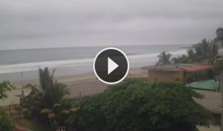
<div style="font-family:Arial,sans-serif; font-size:9px; letter-spacing:1.5px; text-transform:uppercase; font-weight:bold; color:#0a7a5a; margin-bottom:4px; | <div style="font-family:Arial,sans-serif; font-size:9px; letter-spacing:1.5px; text-transform:uppercase; font-weight:bold; color:#0a7a5a; margin-bottom:4px;">Montañita · Pueblo</div> | ||
<div style="font-size:1em; font-weight:bold; color:#0a4a3a; margin-bottom:8px; | <div style="font-size:1em; font-weight:bold; color:#0a4a3a; margin-bottom:8px;">Montañita Pueblo</div> | ||
<html><a href="https://www.skylinewebcams.com/en/webcam/ecuador/santa-elena/santa-elena/montanita-santa-elena.html" target="_blank"><img src="https://embed.skylinewebcams.com/img/2205.jpg" alt="【LIVE】 Montañita - Santa Elena | SkylineWebcams" style="width:100%; height:auto; display:block; border-radius:3px;"></a></html> | <html><a href="https://www.skylinewebcams.com/en/webcam/ecuador/santa-elena/santa-elena/montanita-santa-elena.html" target="_blank"><img src="https://embed.skylinewebcams.com/img/2205.jpg" alt="【LIVE】 Montañita - Santa Elena | SkylineWebcams" style="width:100%; height:auto; display:block; border-radius:3px;"></a></html> | ||
<div style="font-family:Arial,sans-serif; font-size:0.78em; color:#8a8a8a; margin-top:8px; line-height:1.4;"> | <div style="font-family:Arial,sans-serif; font-size:0.78em; color:#8a8a8a; margin-top:8px; line-height:1.4;">Vista del lado del pueblo — nivel de afluencia y condiciones generales. Haz clic en la imagen para ver la transmisión en vivo.</div> | ||
</div> | </div> | ||
|} | |} | ||
| Line 254: | Line 254: | ||
<div style="height:4px; background:#1db894;"></div> | <div style="height:4px; background:#1db894;"></div> | ||
<div style="padding:13px 14px 10px;"> | <div style="padding:13px 14px 10px;"> | ||
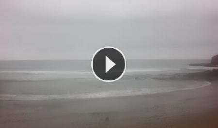
<div style="font-family:Arial,sans-serif; font-size:9px; letter-spacing:1.5px; text-transform:uppercase; font-weight:bold; color:#1db894; margin-bottom:4px; | <div style="font-family:Arial,sans-serif; font-size:9px; letter-spacing:1.5px; text-transform:uppercase; font-weight:bold; color:#1db894; margin-bottom:4px;">Montañita · Rompiente de Surf</div> | ||
<div style="font-size:1em; font-weight:bold; color:#0a4a3a; margin-bottom:8px; | <div style="font-size:1em; font-weight:bold; color:#0a4a3a; margin-bottom:8px;">Montañita La Punta</div> | ||
<html><a href="https://www.skylinewebcams.com/en/webcam/ecuador/santa-elena/santa-elena/montanita.html" target="_blank"><img src="https://embed.skylinewebcams.com/img/5706.jpg" alt="【LIVE】 Beach of Montañita | SkylineWebcams" style="width:100%; height:auto; display:block; border-radius:3px;"></a></html> | <html><a href="https://www.skylinewebcams.com/en/webcam/ecuador/santa-elena/santa-elena/montanita.html" target="_blank"><img src="https://embed.skylinewebcams.com/img/5706.jpg" alt="【LIVE】 Beach of Montañita | SkylineWebcams" style="width:100%; height:auto; display:block; border-radius:3px;"></a></html> | ||
<div style="font-family:Arial,sans-serif; font-size:0.78em; color:#8a8a8a; margin-top:8px; line-height:1.4;"> | <div style="font-family:Arial,sans-serif; font-size:0.78em; color:#8a8a8a; margin-top:8px; line-height:1.4;">La rompiente de punta — tamaño del oleaje, forma y cantidad de surfistas en el lineup. Haz clic en la imagen para ver la transmisión en vivo.</div> | ||
</div> | </div> | ||
| style="width:50%; border:1px solid #c8e6dc; border-radius:6px; overflow:hidden; vertical-align:top; padding:0; background:#ffffff;" | | | style="width:50%; border:1px solid #c8e6dc; border-radius:6px; overflow:hidden; vertical-align:top; padding:0; background:#ffffff;" | | ||
<div style="height:4px; background:#0a7a5a;"></div> | <div style="height:4px; background:#0a7a5a;"></div> | ||
<div style="padding:13px 14px 10px;"> | <div style="padding:13px 14px 10px;"> | ||
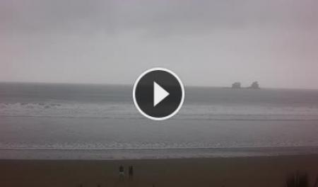
<div style="font-family:Arial,sans-serif; font-size:9px; letter-spacing:1.5px; text-transform:uppercase; font-weight:bold; color:#0a7a5a; margin-bottom:4px; | <div style="font-family:Arial,sans-serif; font-size:9px; letter-spacing:1.5px; text-transform:uppercase; font-weight:bold; color:#0a7a5a; margin-bottom:4px;">Ayampe · Costa de Bosque Nuboso</div> | ||
<div style="font-size:1em; font-weight:bold; color:#0a4a3a; margin-bottom:8px;"><span lang="en" dir="ltr" class="mw-content-ltr">Playa Ayampe</span></div> | <div style="font-size:1em; font-weight:bold; color:#0a4a3a; margin-bottom:8px;"><span lang="en" dir="ltr" class="mw-content-ltr">Playa Ayampe</span></div> | ||
<html><a href="https://www.skylinewebcams.com/en/webcam/ecuador/manabi/puerto-lopez/playa-ayampe.html" target="_blank"><img src="https://embed.skylinewebcams.com/img/5710.jpg" alt="【LIVE】 Beach of Ayampe | SkylineWebcams" style="width:100%; height:auto; display:block; border-radius:3px;"></a></html> | <html><a href="https://www.skylinewebcams.com/en/webcam/ecuador/manabi/puerto-lopez/playa-ayampe.html" target="_blank"><img src="https://embed.skylinewebcams.com/img/5710.jpg" alt="【LIVE】 Beach of Ayampe | SkylineWebcams" style="width:100%; height:auto; display:block; border-radius:3px;"></a></html> | ||
Revision as of 01:56, 28 August 2026
|
~200 km
Ruta costera
|
12+
Pueblos y aldeas
|
E-15
Carretera
|
3,500 BC
Inicio del comercio de Spondylus
|
Jun–Sep
Temporada de ballenas
|
|
"Un camino que no solo conecta lugares — conecta formas de vida. Cada pocos kilómetros la costa se reinventa."
La Ruta del Spondylus toma su nombre de la concha de ostra espinosa que fue el artículo de comercio más sagrado del Ecuador precolombino. Durante milenios, los pueblos costeros intercambiaron el Spondylus como moneda, ofrenda y símbolo de lluvia y fertilidad — y la red de comunidades a lo largo de esta costa fueron quienes lo recolectaron, comerciaron y veneraron. Hoy la ruta es la carretera E-15, que va hacia el norte desde la Península de Santa Elena, atraviesa la Provincia de Santa Elena y llega hasta Manabí. Pasa por una docena de pueblos distintos, cada uno con su propio carácter: Ayangue es una caleta turquesa protegida, perfecta para bucear con esnórquel. Manglaralto es tranquilo y local. Montañita es uno de los destinos de surf más conocidos internacionalmente en Sudamérica. Olón tiene una playa amplia y apacible y una iglesia en lo alto de un acantilado visible desde kilómetros de distancia. Más al norte, la costa se vuelve más salvaje — caballos en la playa de San José, acantilados dramáticos en La Rinconada, retiros de yoga y bosque nuboso en Ayampe. La ruta se puede recorrer fácilmente en bus desde el Terminal Terrestre de La Libertad, con salidas frecuentes durante todo el día.
Pueblos de la Ruta Enumerados de sur a norte, en orden de viaje desde la península.
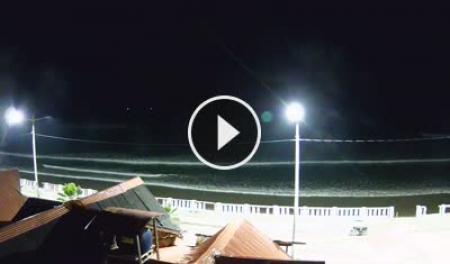
Cámaras en Vivo de las Playas Condiciones actuales a lo largo de la ruta — las imágenes se actualizan automáticamente. Haz clic en cualquier imagen para abrir la transmisión en vivo.
Images refresh every few minutes on the SkylineWebcams servers. Cams run south to north in route order.
Starting from the Peninsula
The Ruta del Spondylus begins where the Santa Elena Peninsula ends. Frequent buses run north from La Libertad's Terminal Terrestre throughout the day, stopping at every town along the route. You can travel the full length in a single day, or base yourself in one town and explore on foot.
Geography & Landscape
The Spondylus Shell 3500 BC onwards
The Spondylus princeps — the thorny oyster — is harvested by coastal divers along this stretch of coast. It becomes the single most important trade item in pre-Columbian South America, exchanged from Ecuador to Chile and from the coast to the high Andes.
Ritual significance
Andean cultures — including the Inca — believed Spondylus had the power to bring rain. Its crimson interior color was associated with blood, sacrifice, and the sea goddess. Only nobility and priests could possess it.
The trade network
The coastal communities along this route were the source. Balsa-wood trading vessels — some large enough for 20 people — carried shells north and south. The Spanish conquistadors first encountered these boats off the coast of what is now Santa Elena Province.
Today
The shell gives its name to the modern highway, and local artisans still carve and sell Spondylus jewelry in Montañita and other market towns along the route. The diving tradition that started 5,000 years ago continues in Ayangue and Anconcito.
Nature & Ecology
Outdoor Activities Each activity links to its own page with spots, conditions, access, difficulty, and local operators.
Getting There & Around
|
|