Surfing (La Peninsula): Difference between revisions
No edit summary |
No edit summary |
||
| Line 296: | Line 296: | ||
<div style="font-family:Arial,sans-serif; font-size:9px; letter-spacing:1.5px; text-transform:uppercase; font-weight:bold; color:#0093c4; margin-bottom:4px;">Salinas · Bay area</div> | <div style="font-family:Arial,sans-serif; font-size:9px; letter-spacing:1.5px; text-transform:uppercase; font-weight:bold; color:#0093c4; margin-bottom:4px;">Salinas · Bay area</div> | ||
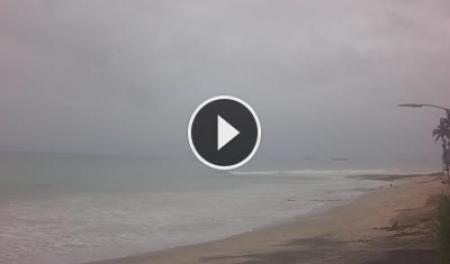
<div style="font-size:1em; font-weight:bold; color:#003d5c; margin-bottom:8px;">Paco Illescas <span style="font-weight:normal; color:#7a7a7a; font-size:0.85em;">(Barco Hundido)</span></div> | <div style="font-size:1em; font-weight:bold; color:#003d5c; margin-bottom:8px;">Paco Illescas <span style="font-weight:normal; color:#7a7a7a; font-size:0.85em;">(Barco Hundido)</span></div> | ||
<html>< | <html><a href="https://www.skylinewebcams.com/en/webcam/ecuador/santa-elena/salinas/paco-illescas.html" target="_blank"><img src="https://embed.skylinewebcams.com/img/5700.jpg" alt="【LIVE】 Salinas - Santa Elena | SkylineWebcams" style="width:100%; height:auto; display:block; border-radius:3px;"></a></html> | ||
<div style="font-family:Arial,sans-serif; font-size:0.78em; color:#8a8a8a; margin-top:8px; line-height:1.4;">Covers the Paco Illescas / Barco Hundido area. Good for reading bay swell direction and wind chop on the inner bay breaks (El Muelle, La Diablica bay, Shitbay). | <div style="font-family:Arial,sans-serif; font-size:0.78em; color:#8a8a8a; margin-top:8px; line-height:1.4;">Covers the Paco Illescas / Barco Hundido area. Good for reading bay swell direction and wind chop on the inner bay breaks (El Muelle, La Diablica bay, Shitbay). Click image to open live feed.</div> | ||
</div> | </div> | ||
| style="width:50%; border:1px solid #d0dce8; border-radius:6px; overflow:hidden; vertical-align:top; padding:0; background:#ffffff;" | | | style="width:50%; border:1px solid #d0dce8; border-radius:6px; overflow:hidden; vertical-align:top; padding:0; background:#ffffff;" | | ||
| Line 305: | Line 304: | ||
<div style="font-family:Arial,sans-serif; font-size:9px; letter-spacing:1.5px; text-transform:uppercase; font-weight:bold; color:#1d6b40; margin-bottom:4px;">Ballenita · East bay</div> | <div style="font-family:Arial,sans-serif; font-size:9px; letter-spacing:1.5px; text-transform:uppercase; font-weight:bold; color:#1d6b40; margin-bottom:4px;">Ballenita · East bay</div> | ||
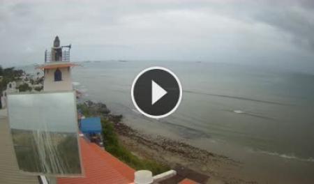
<div style="font-size:1em; font-weight:bold; color:#003d5c; margin-bottom:8px;">Playa de Ballenita – Capaes</div> | <div style="font-size:1em; font-weight:bold; color:#003d5c; margin-bottom:8px;">Playa de Ballenita – Capaes</div> | ||
<html>< | <html><a href="https://www.skylinewebcams.com/en/webcam/ecuador/santa-elena/santa-elena/playa-de-ballenita-capaes.html" target="_blank"><img src="https://embed.skylinewebcams.com/img/3724.jpg" alt="【LIVE】 Playa de Ballenita - Capaes | SkylineWebcams" style="width:100%; height:auto; display:block; border-radius:3px;"></a></html> | ||
<div style="font-family:Arial,sans-serif; font-size:0.78em; color:#8a8a8a; margin-top:8px; line-height:1.4;">Covers Ballenita beach (Chulluype zone). Useful for checking whether swell is wrapping into the bay and what the wind is doing before the drive out from Salinas. | <div style="font-family:Arial,sans-serif; font-size:0.78em; color:#8a8a8a; margin-top:8px; line-height:1.4;">Covers Ballenita beach (Chulluype zone). Useful for checking whether swell is wrapping into the bay and what the wind is doing before the drive out from Salinas. Click image to open live feed.</div> | ||
</div> | </div> | ||
|} | |} | ||
Revision as of 16:36, 19 May 2026
|
10+
Known breaks
|
Dec–Apr
Peak season
|
1–8 ft
Typical swell
|
22 °C
Avg water temp
|
|
"Not the big-name swells of Montañita — but uncrowded, consistent, and honest. If you know where to look, La Península gives you waves to yourself."
The Santa Elena Peninsula sits at the convergence of the Humboldt and Equatorial currents, creating surf conditions unlike anywhere else on Ecuador's coast. The bay side offers sheltered, forgiving beach breaks for beginners; the open Pacific headlands catch raw swell for intermediate and experienced surfers. The peninsula is typically a stopover on the way north to Montañita — which means the breaks here are rarely crowded.
Surf Spots The peninsula's breaks are spread across three zones: the open south coast (Punta Carnero–Anconcito corridor), the Salinas bay (sheltered inner-bay breaks), and the Ballenita / Punta Blanca stretch to the east. Spots are listed roughly west-to-east. Open South Coast
Salinas Bay
The inner bay breaks require swell to wrap around the tip of La Chocolatera to arrive with enough energy. In smaller conditions they can be mellow and fun; on bigger swells they can produce surprisingly punchy, hollow waves. All are more accessible and less exposed than the south coast spots.
Ballenita, Punta Blanca & North Coast
A further option worth noting: Punta Carnero, south of Salinas, produces irregular but occasionally excellent reef waves on large SW swells. Access is difficult, conditions unpredictable, and rip currents are present — locals only, no instructor should bring beginners here.
Seasonal Conditions
Peak Good Fair Flat / off-season
Check Ocean Conditions Live webcams covering two key breaks on the peninsula. Images refresh automatically — use them to get a quick read on swell size, wind texture, and crowd level before heading out.
Images refresh every few minutes on the SkylineWebcams servers. No webcam covers the south coast (La Diablica, Punta Carnero) — check Windguru for those spots.
Getting There All zones are accessible from Salinas (the logical base). Bay breaks like El Muelle, La Chueca, La Diablica (San Lorenzo), Shitbay, and Barco Hundido are within the Salinas urban area — walkable or a short taxi ride. Chulluype and Ballenita are 15 minutes east by taxi or bus. Punta Blanca and Coito (Punta Barandúa) are a 25-minute ride toward Chanduy — taxis are cheapest; there is no direct bus. For the south coast (La Diablica Punta Carnero–Anconcito, Punta Carnero), allow 15–20 minutes by taxi from central Salinas. The journey from Guayaquil takes about 2 hours via the E-40. See Public Transportation for bus routes and Taxis & Apps for typical fares between towns.
Lessons & Rentals Operator listings are community-contributed and may change. If you know of a school or rental not listed, add it to the Operators Directory.
Forecast Resources No surf-specific forecast service covers La Península directly. These options work for the area:
Note: south coast spots (La Diablica Punta Carnero, Punta Carnero reef) respond more directly to S/SW groundswell than the Montañita forecast implies — cross-reference with a Santa Elena point forecast for those breaks.
Related Activities
|
|