
Portal:Ruta del Spondylus: Difference between revisions
Add daily El Niño Report widget below the hero |
Marked this version for translation |
||
| (2 intermediate revisions by the same user not shown) | |||
| Line 145: | Line 145: | ||
* [[Snorkeling (Ruta del Spondylus)|Snorkeling]] | * [[Snorkeling (Ruta del Spondylus)|Snorkeling]] | ||
* [[Punta Blanca]] — quiet and close to town | * [[Punta Blanca]] — quiet and close to town | ||
* [[Beaches]] — every beach on the route, compared | |||
</translate></div> | </translate></div> | ||
<div class="ewp-card ewp-path p3"><div class="ewp-emoji">🌿</div><div class="t"><translate><!--T:286--> Nature and quiet</translate></div> | <div class="ewp-card ewp-path p3"><div class="ewp-emoji">🌿</div><div class="t"><translate><!--T:286--> Nature and quiet</translate></div> | ||
| Line 161: | Line 162: | ||
* [[San Biritute]] — the rain-bringing stone | * [[San Biritute]] — the rain-bringing stone | ||
* [[Colonche]] — the historic parish town of the north | * [[Colonche]] — the historic parish town of the north | ||
* [[How the Comunas Work]] — how the villages run themselves | |||
</translate></div> | </translate></div> | ||
</div> | </div> | ||
| Line 168: | Line 170: | ||
<div class="ewp-h2"><translate><!--T:291--> The route, stop by stop</translate></div> | <div class="ewp-h2"><translate><!--T:291--> The route, stop by stop</translate></div> | ||
<div class="ewp-lead"><translate><!--T:292--> Buses leave Terminal Sumpa all day and stop in every village. Tap a stop to explore it. (Ayampe and Las Tunas are across the border in Manabí.)</translate></div> | <div class="ewp-lead"><translate><!--T:292--> Buses leave Terminal Sumpa all day and stop in every village. Tap a stop to explore it. (Ayampe and Las Tunas are across the border in Manabí.)</translate></div> | ||
<div class="ewp-route"><span class="ewp-stop">[[Terminal Terrestre Regional Sumpa (Santa Elena)|Sumpa 🚌]]</span><span class="ewp-stop">[[Ballenita|Ballenita]]</span><span class="ewp-stop">[[Punta Blanca|Punta Blanca]]</span><span class="ewp-stop">[[Ayangue|Ayangue]]</span><span class="ewp-stop">[[Valdivia|Valdivia]]</span><span class="ewp-stop">[[Manglaralto|Manglaralto]]</span><span class="ewp-stop">[[Montañita|Montañita]]</span><span class="ewp-stop">[[Olón|Olón]]</span><span class="ewp-stop">[[Curia|Curía]]</span><span class="ewp-stop">[[San José|San José]]</span><span class="ewp-stop">[[Las Nuñez|Las Núñez]]</span><span class="ewp-stop">[[La Entrada|La Entrada]]</span><span class="ewp-stop">[[La Rinconada|La Rinconada]]</span><span class="ewp-stop mb">[[Ayampe|Ayampe]]</span><span class="ewp-stop mb">[[Las Tunas|Las Tunas]]</span></div> | <div class="ewp-route"><span class="ewp-stop">[[Terminal Terrestre Regional Sumpa (Santa Elena)|Sumpa 🚌]]</span><span class="ewp-stop">[[Ballenita|Ballenita]]</span><span class="ewp-stop">[[Capaes|Capaes]]</span><span class="ewp-stop">[[Punta Barandúa|Punta Barandúa]]</span><span class="ewp-stop">[[Punta Blanca|Punta Blanca]]</span><span class="ewp-stop">[[Punta Centinela|Punta Centinela]]</span><span class="ewp-stop">[[San Pablo|San Pablo]]</span><span class="ewp-stop">[[Monteverde|Monteverde]]</span><span class="ewp-stop">[[Jambelí|Jambelí]]</span><span class="ewp-stop">[[Palmar|Palmar]]</span><span class="ewp-stop">[[Playa Rosada|Playa Rosada]]</span><span class="ewp-stop">[[Ayangue|Ayangue]]</span><span class="ewp-stop">[[San Pedro|San Pedro]]</span><span class="ewp-stop">[[Valdivia|Valdivia]]</span><span class="ewp-stop">[[Libertador Bolívar|Libertador Bolívar]]</span><span class="ewp-stop">[[San Antonio|San Antonio]]</span><span class="ewp-stop">[[Cadeate|Cadeate]]</span><span class="ewp-stop">[[Río Chico|Río Chico]]</span><span class="ewp-stop">[[Manglaralto|Manglaralto]]</span><span class="ewp-stop">[[Montañita|Montañita]]</span><span class="ewp-stop">[[Olón|Olón]]</span><span class="ewp-stop">[[Curia|Curía]]</span><span class="ewp-stop">[[San José|San José]]</span><span class="ewp-stop">[[Las Nuñez|Las Núñez]]</span><span class="ewp-stop">[[La Entrada|La Entrada]]</span><span class="ewp-stop">[[La Rinconada|La Rinconada]]</span><span class="ewp-stop mb">[[Ayampe|Ayampe]]</span><span class="ewp-stop mb">[[Las Tunas|Las Tunas]]</span></div> | ||
<div class="ewp-grid" style="margin-top:16px;"> | <div class="ewp-grid" style="margin-top:16px;"> | ||
<div class="ewp-card"><span class="ewp-tag"><translate><!--T:293--> Protected bay</translate></span><div class="t">[[Ayangue|Ayangue]]</div><div class="d"><translate><!--T:294--> A sheltered turquoise cove nicknamed the "Pacific Pool" — calm and clear enough to snorkel almost all year.</translate></div><span class="ewp-chip"><translate><!--T:295--> 🤿 Snorkeling</translate></span></div> | <div class="ewp-card"><span class="ewp-tag"><translate><!--T:293--> Protected bay</translate></span><div class="t">[[Ayangue|Ayangue]]</div><div class="d"><translate><!--T:294--> A sheltered turquoise cove nicknamed the "Pacific Pool" — calm and clear enough to snorkel almost all year.</translate></div><span class="ewp-chip"><translate><!--T:295--> 🤿 Snorkeling</translate></span></div> | ||
| Line 182: | Line 184: | ||
<div class="ewp-card"><span class="ewp-tag"><translate><!--T:323--> Into Manabí</translate></span><div class="t">[[Ayampe|Ayampe]]</div><div class="d"><translate><!--T:324--> Where the forest meets the Pacific: surf, yoga and remarkable wildlife.</translate></div><span class="ewp-chip"><translate><!--T:325--> 🧘 Yoga · surf</translate></span></div> | <div class="ewp-card"><span class="ewp-tag"><translate><!--T:323--> Into Manabí</translate></span><div class="t">[[Ayampe|Ayampe]]</div><div class="d"><translate><!--T:324--> Where the forest meets the Pacific: surf, yoga and remarkable wildlife.</translate></div><span class="ewp-chip"><translate><!--T:325--> 🧘 Yoga · surf</translate></span></div> | ||
<div class="ewp-card"><span class="ewp-tag"><translate><!--T:326--> Whale passage</translate></span><div class="t">[[Las Tunas|Las Tunas]]</div><div class="d"><translate><!--T:327--> A quiet beach where humpbacks pass close to shore in season.</translate></div><span class="ewp-chip"><translate><!--T:328--> 🐋 Jun–Sep</translate></span></div> | <div class="ewp-card"><span class="ewp-tag"><translate><!--T:326--> Whale passage</translate></span><div class="t">[[Las Tunas|Las Tunas]]</div><div class="d"><translate><!--T:327--> A quiet beach where humpbacks pass close to shore in season.</translate></div><span class="ewp-chip"><translate><!--T:328--> 🐋 Jun–Sep</translate></span></div> | ||
</div> | |||
<div class="ewp-kicker" style="margin-top:18px;"><translate><!--T:437--> More stops</translate></div> | |||
<div class="ewp-h2"><translate><!--T:438--> Small comunas worth a stop</translate></div> | |||
<div class="ewp-grid"> | |||
<div class="ewp-card"><span class="ewp-tag"><translate><!--T:439--> Calm sand</translate></span><div class="t">[[Capaes|Capaes]]</div><div class="d"><translate><!--T:440--> Quiet beach houses and open sand between Ballenita and Punta Blanca — check it on the live cam.</translate></div><span class="ewp-chip"><translate><!--T:441--> 📷 Live cam</translate></span></div> | |||
<div class="ewp-card"><span class="ewp-tag"><translate><!--T:442--> White cliffs</translate></span><div class="t">[[Punta Blanca|Punta Blanca]]</div><div class="d"><translate><!--T:443--> 1.3 km of beach under white cliffs, with the Coito surf break at Punta Barandúa and the Decameron at Punta Centinela.</translate></div><span class="ewp-chip"><translate><!--T:444--> 🏄 Coito</translate></span></div> | |||
<div class="ewp-card"><span class="ewp-tag"><translate><!--T:445--> Long beach</translate></span><div class="t">[[San Pablo|San Pablo]]</div><div class="d"><translate><!--T:446--> 3.2 km of sand — the first big beach town on the route.</translate></div><span class="ewp-chip"><translate><!--T:447--> 🏖️ 3.2 km</translate></span></div> | |||
<div class="ewp-card"><span class="ewp-tag"><translate><!--T:448--> Quiet giant</translate></span><div class="t">[[Monteverde|Monteverde]]</div><div class="d"><translate><!--T:449--> 2 km of quiet beach, next to Ecuador's national cooking-gas terminal.</translate></div><span class="ewp-chip"><translate><!--T:450--> 🏖️ 2 km</translate></span></div> | |||
<div class="ewp-card"><span class="ewp-tag"><translate><!--T:451--> Fishing village</translate></span><div class="t">[[Jambelí|Jambelí]]</div><div class="d"><translate><!--T:452--> A working fishing village with 1.2 km of beach and boats on the sand.</translate></div><span class="ewp-chip"><translate><!--T:453--> 🎣 Fishing</translate></span></div> | |||
<div class="ewp-card"><span class="ewp-tag"><translate><!--T:454--> Mangrove</translate></span><div class="t">[[Palmar|Palmar]]</div><div class="d"><translate><!--T:455--> The province's biggest mangrove, being replanted by local young people.</translate></div><span class="ewp-chip"><translate><!--T:456--> 🛶 Kayak</translate></span></div> | |||
<div class="ewp-card"><span class="ewp-tag"><translate><!--T:457--> Hidden beach</translate></span><div class="t">[[Playa Rosada|Playa Rosada]]</div><div class="d"><translate><!--T:458--> A small beach with sand of a special colour, down a side road between Palmar and Ayangue.</translate></div><span class="ewp-chip"><translate><!--T:459--> 🌸 Hidden</translate></span></div> | |||
<div class="ewp-card"><span class="ewp-tag"><translate><!--T:460--> Fishermen's saint</translate></span><div class="t">[[San Pedro|San Pedro]]</div><div class="d"><translate><!--T:461--> A fishing comuna inside the El Pelado reserve, known for its pilgrimage to Saint Peter.</translate></div><span class="ewp-chip"><translate><!--T:462--> ⛪ Pilgrimage</translate></span></div> | |||
<div class="ewp-card"><span class="ewp-tag"><translate><!--T:463--> Green hills</translate></span><div class="t">[[Sinchal|Sinchal]]</div><div class="d"><translate><!--T:464--> A farming comuna in the hills above Valdivia, with over 1,000 ha of protected forest.</translate></div><span class="ewp-chip"><translate><!--T:465--> 🌳 Forest</translate></span></div> | |||
<div class="ewp-card"><span class="ewp-tag"><translate><!--T:466--> Toquilla straw</translate></span><div class="t">[[Barcelona|Barcelona]]</div><div class="d"><translate><!--T:467--> 80% of the village works the straw that becomes the famous "Panama" hat.</translate></div><span class="ewp-chip"><translate><!--T:468--> 👒 Crafts</translate></span></div> | |||
<div class="ewp-card"><span class="ewp-tag"><translate><!--T:469--> Quiet beach</translate></span><div class="t">[[Libertador Bolívar|Libertador Bolívar]]</div><div class="d"><translate><!--T:470--> 1.3 km of beach with its own estuary, between Valdivia and San Antonio.</translate></div><span class="ewp-chip"><translate><!--T:471--> 🏖️ Estuary</translate></span></div> | |||
<div class="ewp-card"><span class="ewp-tag"><translate><!--T:472--> Cazuela</translate></span><div class="t">[[San Antonio|San Antonio]]</div><div class="d"><translate><!--T:473--> Two estuaries, a golden beach, craftspeople and the famous cazuela de orgía.</translate></div><span class="ewp-chip"><translate><!--T:474--> 🍲 Food</translate></span></div> | |||
<div class="ewp-card"><span class="ewp-tag"><translate><!--T:475--> Clay-oven bread</translate></span><div class="t">[[Cadeate|Cadeate]]</div><div class="d"><translate><!--T:476--> A small beach comuna where bakers still use wood-fired clay ovens.</translate></div><span class="ewp-chip"><translate><!--T:477--> 🍞 Bread</translate></span></div> | |||
<div class="ewp-card"><span class="ewp-tag"><translate><!--T:478--> Near Montañita</translate></span><div class="t">[[Río Chico|Río Chico]]</div><div class="d"><translate><!--T:479--> 1 km of beach and its own estuary, a short ride from Montañita's surf.</translate></div><span class="ewp-chip"><translate><!--T:480--> 🌙 Quiet</translate></span></div> | |||
</div> | </div> | ||
<div class="ewp-lead" style="margin-top:12px;"><translate><!--T:329--> 💡 Every comuna page has a '''community facts''' box: beach length, water supply and who runs the village.</translate></div> | <div class="ewp-lead" style="margin-top:12px;"><translate><!--T:329--> 💡 Every comuna page has a '''community facts''' box: beach length, water supply and who runs the village.</translate></div> | ||
<div class="ewp-lead"><translate><!--T:481--> 🤝 Most of these villages are comunas that own their land together and elect a new council every year — see [[How the Comunas Work]].</translate></div> | |||
<!-- ═══ DID YOU KNOW ═══ --> | <!-- ═══ DID YOU KNOW ═══ --> | ||
| Line 194: | Line 215: | ||
<div class="ewp-card ewp-dyk"><div class="ewp-emoji">🗿</div><div class="q"><translate><!--T:337--> …there's a stone figure inland that local people say brings the rain?</translate></div><div class="ewp-go"><translate><!--T:338--> [[San Biritute|Meet San Biritute →]]</translate></div></div> | <div class="ewp-card ewp-dyk"><div class="ewp-emoji">🗿</div><div class="q"><translate><!--T:337--> …there's a stone figure inland that local people say brings the rain?</translate></div><div class="ewp-go"><translate><!--T:338--> [[San Biritute|Meet San Biritute →]]</translate></div></div> | ||
<div class="ewp-card ewp-dyk"><div class="ewp-emoji">💧</div><div class="q"><translate><!--T:339--> …most villages on the north coast aren't on the big water network — they pump their own groundwater through community water boards?</translate></div><div class="ewp-go"><translate><!--T:340--> [[Water Supply on the Peninsula|How the water works →]]</translate></div></div> | <div class="ewp-card ewp-dyk"><div class="ewp-emoji">💧</div><div class="q"><translate><!--T:339--> …most villages on the north coast aren't on the big water network — they pump their own groundwater through community water boards?</translate></div><div class="ewp-go"><translate><!--T:340--> [[Water Supply on the Peninsula|How the water works →]]</translate></div></div> | ||
<div class="ewp-card ewp-dyk"><div class="ewp-emoji">🤝</div><div class="q"><translate><!--T:341--> …the comunas own their land together and elect a council, the cabildo, every year?</translate></div><div class="ewp-go"><translate><!--T:342--> [[ | <div class="ewp-card ewp-dyk"><div class="ewp-emoji">🤝</div><div class="q"><translate><!--T:341--> …the comunas own their land together and elect a council, the cabildo, every year?</translate></div><div class="ewp-go"><translate><!--T:342--> [[How the Comunas Work|How the comunas work →]]</translate></div></div> | ||
<div class="ewp-card ewp-dyk"><div class="ewp-emoji">🌳</div><div class="q"><translate><!--T:343--> …families in the hills protect hundreds of hectares of forest through the Socio Bosque programme?</translate></div><div class="ewp-go"><translate><!--T:344--> [[Loma Alta Ecological Reserve|Explore the forest →]]</translate></div></div> | <div class="ewp-card ewp-dyk"><div class="ewp-emoji">🌳</div><div class="q"><translate><!--T:343--> …families in the hills protect hundreds of hectares of forest through the Socio Bosque programme?</translate></div><div class="ewp-go"><translate><!--T:344--> [[Loma Alta Ecological Reserve|Explore the forest →]]</translate></div></div> | ||
</div> | </div> | ||
| Line 249: | Line 270: | ||
<div class="ewp-card"><div class="ewp-emoji">🦅</div><div class="t"><translate><!--T:386--> Birds</translate></div><div class="d"><translate><!--T:387--> Seabirds and raptors on the cliffs at La Rinconada; early morning is best.</translate></div><div class="ewp-go"><translate><!--T:388--> [[Birdwatching (Ruta del Spondylus)|Birdwatching →]]</translate></div></div> | <div class="ewp-card"><div class="ewp-emoji">🦅</div><div class="t"><translate><!--T:386--> Birds</translate></div><div class="d"><translate><!--T:387--> Seabirds and raptors on the cliffs at La Rinconada; early morning is best.</translate></div><div class="ewp-go"><translate><!--T:388--> [[Birdwatching (Ruta del Spondylus)|Birdwatching →]]</translate></div></div> | ||
<div class="ewp-card"><div class="ewp-emoji">🏄</div><div class="t"><translate><!--T:389--> Surf breaks</translate></div><div class="d"><translate><!--T:390--> Montañita is the most consistent; Olón, San José and Ayampe suit intermediates.</translate></div><div class="ewp-go"><translate><!--T:391--> [[Surfing (Ruta del Spondylus)|Surf guide →]]</translate></div></div> | <div class="ewp-card"><div class="ewp-emoji">🏄</div><div class="t"><translate><!--T:389--> Surf breaks</translate></div><div class="d"><translate><!--T:390--> Montañita is the most consistent; Olón, San José and Ayampe suit intermediates.</translate></div><div class="ewp-go"><translate><!--T:391--> [[Surfing (Ruta del Spondylus)|Surf guide →]]</translate></div></div> | ||
<div class="ewp-card"><div class="ewp-emoji">🐠</div><div class="t"><translate><!--T:482--> Marine reserve</translate></div><div class="d"><translate><!--T:483--> 13,155 ha of protected sea off Ayangue, Palmar, San Pedro and Valdivia.</translate></div><div class="ewp-go"><translate><!--T:484--> [[El Pelado Marine Reserve|El Pelado →]]</translate></div></div> | |||
<div class="ewp-card"><div class="ewp-emoji">🌲</div><div class="t"><translate><!--T:485--> Protected forest</translate></div><div class="d"><translate><!--T:486--> 53,000 ha of forest on the hills behind the coast, kept green by the garúa.</translate></div><div class="ewp-go"><translate><!--T:487--> [[Bosque Protector Chongón-Colonche|Chongón-Colonche →]]</translate></div></div> | |||
<div class="ewp-card"><div class="ewp-emoji">🦀</div><div class="t"><translate><!--T:488--> Olón's mangroves</translate></div><div class="d"><translate><!--T:489--> Two tiny protected mangroves — some of the last on this coast.</translate></div><div class="ewp-go"><translate><!--T:490--> [[Cangrejal de Olón|Cangrejal de Olón →]]</translate></div></div> | |||
</div> | </div> | ||
Latest revision as of 18:13, 3 November 2026
EcuaWiki › Portals › Ruta del Spondylus
Ruta del Spondylus
A red shell so sacred that Andean peoples offered it to bring the rain gave this road its name. Today it links turquoise bays, surf towns, 5,000-year-old villages and cloud forest — all on one bus line.
Every few kilometres the coast reinvents itself. Find the stretch that's made for you 👇
E-15the coast highway
12+towns and comunas
~73 kmin Santa Elena province
5,000years of Spondylus trade
Jun–Sepwhale season
🌊 Informe El Niño · El Niño Reportmar 3 nov · Tue 3 Nov
+5.4 °CMucho más cálido de lo normalMuch warmer than normal
Océano frente a Ecuador (Niño 1+2), estable · ocean off Ecuador, steady
⚠️ Posibles lluvias fuertes hoy en toda la ruta — cómo protegerse · Heavy rain possible today along the whole route — stay safe
📅 Right now on the route
January — Surf season is on and the water is warm. Montañita's point break is at its best, and the beaches fill up at weekends. Where to surf →
February — Carnival — the busiest days of the year on the coast. Montañita is packed and rooms go weeks ahead. Want calm? Try Olón or Ayangue. Carnival on the coast →
March — Warm sea, green hills after the rains and fewer crowds once Carnival is over. Swim in Ayangue's bay →
April — The rains are ending and the hills are at their greenest — a lovely time to walk inland. Head into the hills →
May — Shoulder season: quiet beaches and lower prices. Perfect for a slow week in Olón. Discover Olón →
June — The humpbacks are back! Look out to sea from the cliffs and beaches all along the route. Where to see whales →
July — Whale season, cooler grey days and school holidays in the highlands — expect visitors from Quito. Book a whale trip →
August — Peak whale season. The misty garúa keeps the cloud forest above the coast lush and green. Walk in the cloud forest →
September — Last chance for whales. The coast is calm, cool and cheap. Watch from the cliffs →
October — The quietest month on the coast: empty beaches and the best prices of the year. Ideal for a slow week in Ayampe. Discover Ayampe →
November — The 2–3 November long weekend fills the beach towns, and on 7 November the province celebrates its birthday. Plan your bus trip →
December — Surf season returns and the holidays bring crowds from Guayaquil. New Year's Eve in Montañita is one of the biggest parties on the coast. Plan a Montañita trip →
Start here
What kind of coast are you looking for?
Same road, four very different trips. Pick yours.
👨👩👧
Calm water and family
- Ayangue — the "Pacific Pool"
- Olón — a long, gentle beach
- Snorkeling
- Punta Blanca — quiet and close to town
- Beaches — every beach on the route, compared
🌿
Nature and quiet
- Dos Mangas — gateway to the hills
- Loma Alta cloud forest
- Manglaralto Estuary
- Birdwatching
🏺
History and culture
- Valdivia — some of the oldest pottery in the Americas
- Real Alto — an ancient village
- San Biritute — the rain-bringing stone
- Colonche — the historic parish town of the north
- How the Comunas Work — how the villages run themselves
South to north
The route, stop by stop
Buses leave Terminal Sumpa all day and stop in every village. Tap a stop to explore it. (Ayampe and Las Tunas are across the border in Manabí.)
Sumpa 🚌BallenitaCapaesPunta BarandúaPunta BlancaPunta CentinelaSan PabloMonteverdeJambelíPalmarPlaya RosadaAyangueSan PedroValdiviaLibertador BolívarSan AntonioCadeateRío ChicoManglaraltoMontañitaOlónCuríaSan JoséLas NúñezLa EntradaLa RinconadaAyampeLas Tunas
Protected bay
A sheltered turquoise cove nicknamed the "Pacific Pool" — calm and clear enough to snorkel almost all year.
🤿 SnorkelingAncient roots
Home of the Valdivia culture, whose pottery is among the oldest in the Americas. Small museum in the village.
🏺 HistoryLocal soul
A quiet parish town with an estuary, a long beach and the north coast's hospital.
🌳 EstuarySurf capital
Ecuador's best-known surf town: consistent waves, a global backpacker scene and late nights.
🏄 Surf · nightlifeFamily retreat
A long, peaceful beach with a clifftop church watching over it. The calm alternative to Montañita.
⛪ Clifftop churchWild shores
One of the most unspoiled beaches on the route — horses on the sand and boats out at dawn.
🐎 Horse ridingArtistic spirit
A small fishing cove with a growing art scene and murals by the sea.
🎨 MuralsDramatic cliffs
High cliffs with sweeping views north and south — great for birds and photos.
🦅 BirdwatchingInto Manabí
Where the forest meets the Pacific: surf, yoga and remarkable wildlife.
🧘 Yoga · surfMore stops
Small comunas worth a stop
Calm sand
Quiet beach houses and open sand between Ballenita and Punta Blanca — check it on the live cam.
📷 Live camWhite cliffs
1.3 km of beach under white cliffs, with the Coito surf break at Punta Barandúa and the Decameron at Punta Centinela.
🏄 CoitoFishing village
A working fishing village with 1.2 km of beach and boats on the sand.
🎣 FishingHidden beach
A small beach with sand of a special colour, down a side road between Palmar and Ayangue.
🌸 HiddenFishermen's saint
A fishing comuna inside the El Pelado reserve, known for its pilgrimage to Saint Peter.
⛪ PilgrimageGreen hills
A farming comuna in the hills above Valdivia, with over 1,000 ha of protected forest.
🌳 ForestToquilla straw
80% of the village works the straw that becomes the famous "Panama" hat.
👒 CraftsQuiet beach
1.3 km of beach with its own estuary, between Valdivia and San Antonio.
🏖️ EstuaryCazuela
Two estuaries, a golden beach, craftspeople and the famous cazuela de orgía.
🍲 FoodNear Montañita
1 km of beach and its own estuary, a short ride from Montañita's surf.
🌙 Quiet💡 Every comuna page has a community facts box: beach length, water supply and who runs the village.
🤝 Most of these villages are comunas that own their land together and elect a new council every year — see How the Comunas Work.
Curiosity corner
Did you know…?
The stories most visitors drive straight past.
🐚
…the Spondylus shell was so precious that it travelled from this coast all the way to the high Andes?
🏺
…Valdivia pottery, made here around 5,500 years ago, is among the oldest in the Americas?
💧
…most villages on the north coast aren't on the big water network — they pump their own groundwater through community water boards?
🤝
…the comunas own their land together and elect a council, the cabildo, every year?
🌳
…families in the hills protect hundreds of hectares of forest through the Socio Bosque programme?
Live
See the waves right now
Live images, south to north. Click an image to open the live feed.
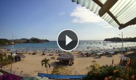
Ayangue · the bay
How clear is the water today?
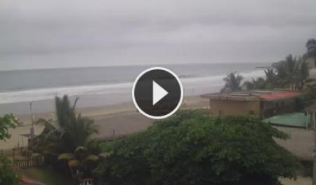
Montañita · town
How busy is the beach?
Montañita · La Punta
Swell size and crowd in the line-up.
Ayampe
Surf and wind where the forest meets the sea.
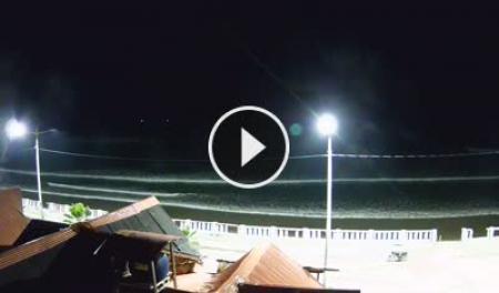
Las Tunas
The northern end — whale corridor in season.
The Ruta bucket list
How many have you done?
You've already ticked the first one. 😉
- ✅ Found EcuaWiki
- ⬜ Snorkel in Ayangue's turquoise bay
- ⬜ Catch (or try to catch) a wave in Montañita
- ⬜ Watch the sunset from the Olón Church Mirador
- ⬜ See 5,000-year-old pottery in Valdivia
- ⬜ Walk in the cloud forest at Loma Alta
- ⬜ Spot a humpback from the cliffs (June–September)
- ⬜ Ride a horse along the beach at San José
- ⬜ Paddle the Manglaralto Estuary
- ⬜ Ride the bus all the way from Sumpa to Olón (how)
Why "Spondylus"?
The shell that named a road
From 3500 BC
Divers on this coast harvest the thorny oyster, Spondylus. It becomes one of the most valuable trade goods in ancient South America, carried from Ecuador deep into the Andes.Sacred
Andean peoples, including the Inca, linked its red shell with water and fertility and offered it to bring the rain.Trade by sea
Big balsa-wood rafts carried shells along the coast. The Spanish met one of these trading rafts off the Ecuadorian coast in the 1520s.Today
The shell gives its name to the E-15, and artisans still make Spondylus jewellery. More nearby: Valdivia, Real Alto and San Biritute.Wild side
Nature along the route
🌫️
Cloud forest
Loma Alta and the hills around Ayampe: orchids, endemic birds and howler monkeys.
🐢
Marine life
Turtles, rays and reef fish in Ayangue's bay, close to the El Pelado marine reserve.
🏄
Surf breaks
Montañita is the most consistent; Olón, San José and Ayampe suit intermediates.
🌲
Protected forest
53,000 ha of forest on the hills behind the coast, kept green by the garúa.
32 ways to spend a day
What do you feel like doing?
Each activity has its own page with spots, conditions and local tips.
Getting there
Easier than you think
🚗
By car
About 2½ hours from Guayaquil to Montañita on the E-40 and E-15. A bypass near San Pablo lets through traffic skip the towns.
🛣️
The road
The E-15 runs about 750 km along Ecuador's coast. In very heavy rain a few stretches can close for landslides.
Good to know
At a glance
| Provinces | Santa Elena → Manabí |
| Highway | E-15 |
| In Santa Elena | about 73 km |
| Starts at | Terminal Sumpa |
| Parishes | Colonche, Manglaralto |
| Currency | US dollar |
Emergencies
911
- Hospitals — nearest: Hospital Básico Manglaralto
- Police
- Pharmacies on duty
- Natural hazards
- All emergency numbers
Seasons
- Dec–Apr — warm water, best surf, busiest
- Feb/Mar — Carnival: book weeks ahead
- Jun–Sep — whale season, cooler and cheaper
- Oct–Nov — the quietest, cheapest months
🏗️ Know this coast? Share it.
951 guides so far, written by people who live here. A secret beach, a bus time, the best encebollado in Olón — add it in five minutes and help the next traveller.